A pretty image doesn't guarantee a useful dataset.
Anyone can fly a drone and produce an orthophoto that looks good. CAPTURE validates that your data is technically reliable for engineering decisions — before, during and after the flight.
We don't reinvent photogrammetry: we use OpenDroneMap as the reconstruction engine and turn it into a technical assurance system.
Your pilot, contractor or in-house team flies. CAPTURE gives them the optimal technical plan and validates the capture in real time.
OpenDroneMap reconstructs the model while CAPTURE audits matching, density, reprojection error and weak areas.
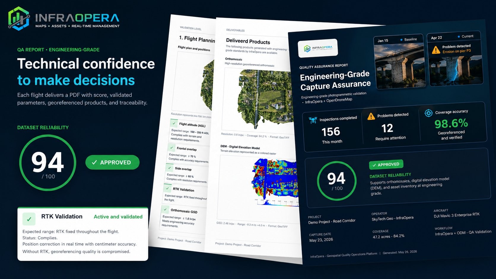
Deliverables ready to operate plus a quality report that tells you how reliable the dataset is and what it's good for.
The client can't assess photogrammetric quality, so the market buys on price, visual resolution or number of photos. But a pretty orthophoto can be geometrically useless. CAPTURE encapsulates the judgment of a photogrammetrist, a surveyor and a geomatics engineer into automated workflows.
Anyone flies. CAPTURE controls the standard — it democratizes capture without democratizing quality.
Tell us what you want to produce —orthomosaic, DEM, volumes, dense cloud, inspection, road corridor, power line, mine— and CAPTURE computes the flight plan that meets the technical criteria.
Before takeoff, CAPTURE assesses the flight geometry, the operational conditions and the sensor, and issues a technical score with reconstruction-risk warnings.
CAPTURE doesn't wait for final processing. While the pilot captures, it reviews the EXIF metadata and detects errors on site — because the biggest cost in photogrammetry isn't processing, it's going back to the site.
During matching, the sparse and dense cloud, the mesh, the DEM and the orthomosaic, CAPTURE analyzes the real quality of the reconstruction and generates an assurance report.
CAPTURE delivers a report that answers what truly matters: can I trust this data to make decisions?
Expected accuracy, reliability, limitations, non-conforming areas, quality score and fitness for use.
CAPTURE checks the criteria a photogrammetrist would review by hand: effective RTK connection, photos taken at a consistent altitude, GSD within the expected range, adequate overlap and more.
AI in CAPTURE isn't an ornament: it works at the points where expert judgment makes the difference.
Evaluates the photo batch and flags missing RTK, inconsistent altitudes, out-of-range GSD or insufficient overlap.
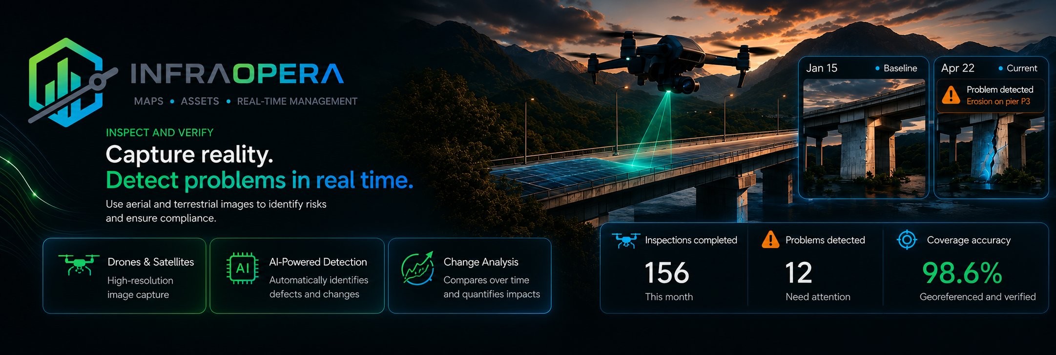
Identifies cracks, corrosion and anomalies on the orthomosaic and inspection images.
Compares flights over time and quantifies changes: erosion, construction progress, displacements.
Recognizes and classifies elements in the point cloud and the orthomosaic to speed up the inventory.
Open standard formats, georeferenced and ready for your GIS and engineering workflow.
High-resolution georeferenced aerial image.
Digital surface and terrain models.
Topography with contours at a configurable interval.
Textured three-dimensional mesh of the site.
Dense, in LAS / LAZ formats.
Georeferenced raster for your GIS.
Raster and vector mosaics for the web.
The one that says whether the data is reliable.
Three tiers based on the photos you process per month. Technical validation is included in all of them.
To start mapping and processing your flights with technical validation.
For those who process seriously: DTM, 3D mesh and priority queue.
High volume, AI detection and multiple processing runs.
Let CAPTURE be the digital technical supervisor of every flight in your operation.