InfraOpera was born from a simple, powerful idea: infrastructure is already digitized, but it still isn't operated digitally.
Maps that show. Drones that capture. But between the data and the action in the field there's a gap: no one executes on the map. InfraOpera exists to close that gap — so every asset has a status, every task has evidence and every decision has backing. We are the operational layer of the territory.
To give every infrastructure operator real control of their territory: visible, traceable and defensible, on a live map and in the palm of their hand.
To be the standard by which physical infrastructure is operated — from a road corridor to a condominium — turning the territory into an operating system.
That no infrastructure decision is made blindly. That asset knowledge lives in the organization, not in the memory of a few people.
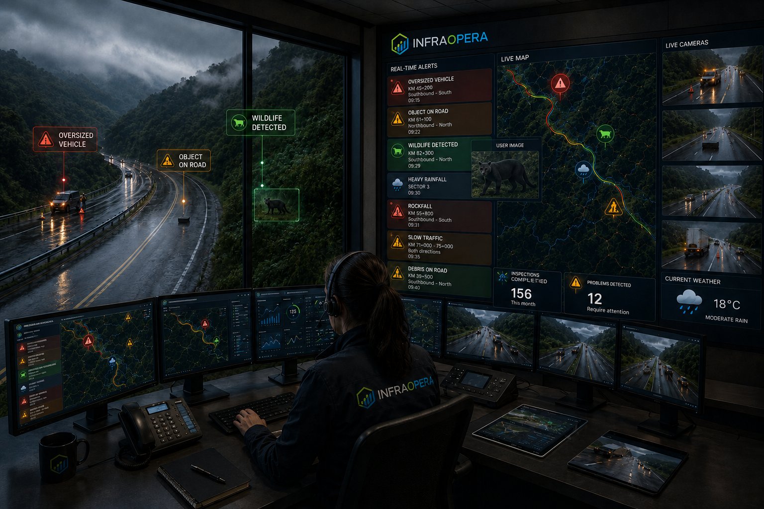
Infrastructure is among the most expensive things to build and maintain, and yet it's operated with information scattered across drawings, contracts, photos and WhatsApp/SMS/email messages. When someone demands accountability — a supervisory body, a board, an insurer, a regulator — gathering the evidence takes weeks and leaves gaps that cost money.
We built InfraOpera to make that problem disappear: a single source of truth, georeferenced, with evidence of every intervention and its date. It's not just another GIS, nor just another drone software. It's the layer that connects geography with real operational execution.
We've been on both sides: sales, construction and consulting. We were specialists in capturing information as engineering, geodesy and surveying were merging into geomatics. It's the perfect moment.
InfraOpera isn't born of theory. It's born of understanding, firsthand, how infrastructure is operated in the real world — where scattered data, inspections without evidence and contractors without oversight cost time and money every day.
We combine experience in infrastructure design, construction and operation, surveying and geospatial development to build a platform that solves real problems, not catalog features. Every product decision is made with the person in the field and the person accountable in the office in mind.
Don't take our word for it, see for yourself
The best perfume is tested on the skin
No one had solved this integration in a single place. Try it free, with limited space, and judge it firsthand.
Try it freeWe don't sell pretty maps. We sell real operational control, with evidence that holds up to whoever demands accountability.
We build on GeoJSON, MapLibre and open tools. Your information is yours, it isn't held hostage.
We don't promise capabilities that don't exist. What's in development is stated as such; what works, we demonstrate.
Every industry operates differently. We design the solution to fit your infrastructure and your responsibility in the field.
Tell us what infrastructure you manage and we'll show you how InfraOpera puts it under control.