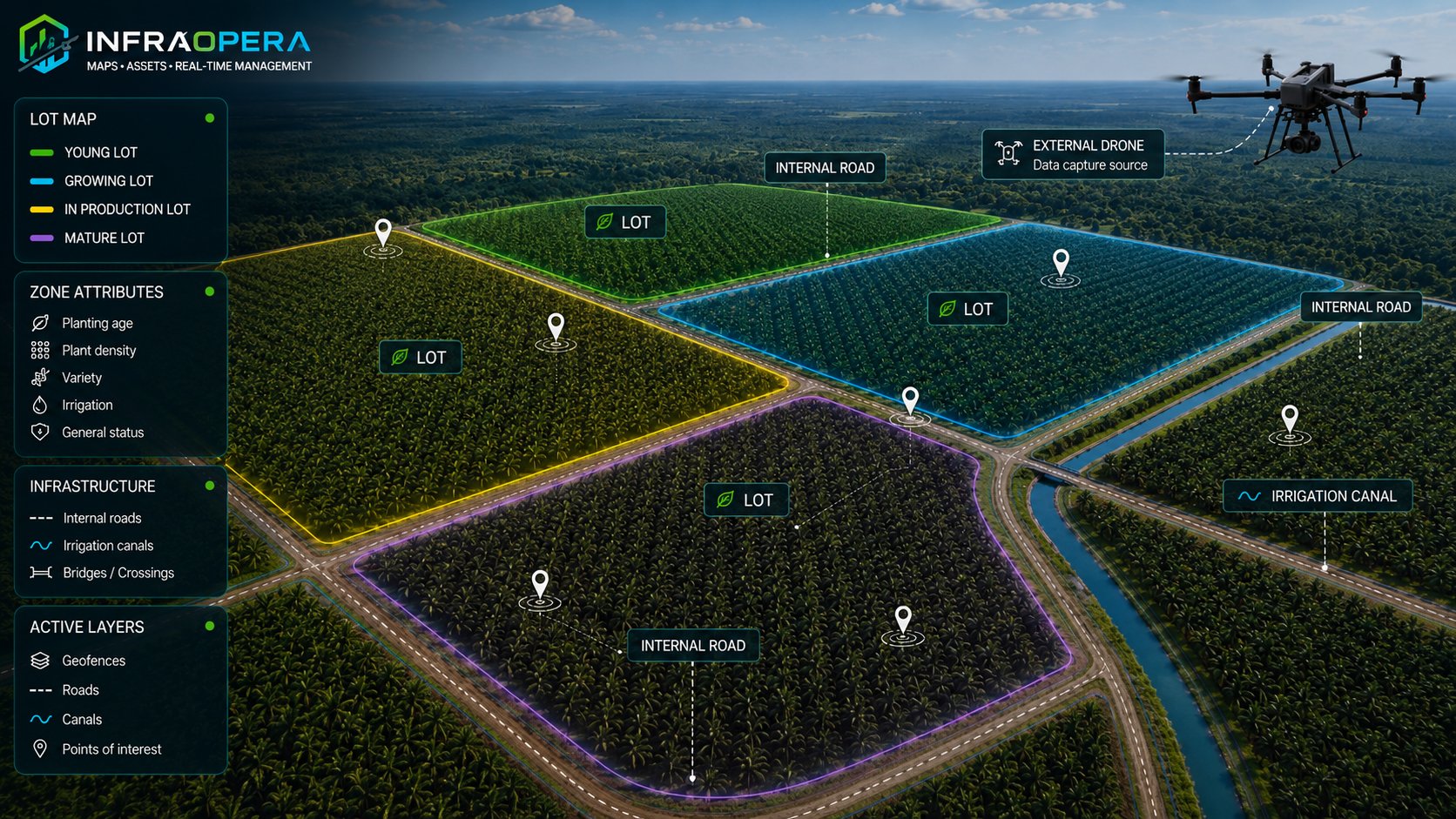
Operate thousands of hectares field by field, paddock by paddock
Sugarcane, oil palm, pineapple, citrus, rotational grazing or intensive fattening: each field with its planting date and age, each paddock with its rotation, each irrigation channel and each piece of equipment on a live map. InfraOpera provides the software to control the operation and give it geospatial traceability — you provide the knowledge of the land.
Thousands of hectares operated blind and in notebooks
A sugar mill, an oil palm plantation or a cattle ranch manages hundreds or thousands of hectares with fields of different ages, staggered harvest schedules and paddock rotations — all managed with notebooks, memory and WhatsApp/SMS/email. This is what costs production and closes off markets:
No one knows the exact age of each field
Which field was planted when, which ratoon it's on, which paddock has been occupied longest: that calendar lives in the foreman's head. Without a map showing each field's date, harvesting and rotation are done by habit, not by data.
Tasks and inputs without geographic traceability
The report says the input was applied or the harvest was done, but without a geolocated position and date per field, that defends nothing before a certification (RSPO, GlobalG.A.P.) or the buyer.
Irrigation infrastructure fails and no one finds out
A broken channel, a stopped pump, a clogged sprinkler in a distant field: by the time someone reports it, the field has already gone days without water. Across thousands of hectares, what isn't on the map doesn't get attended to in time.
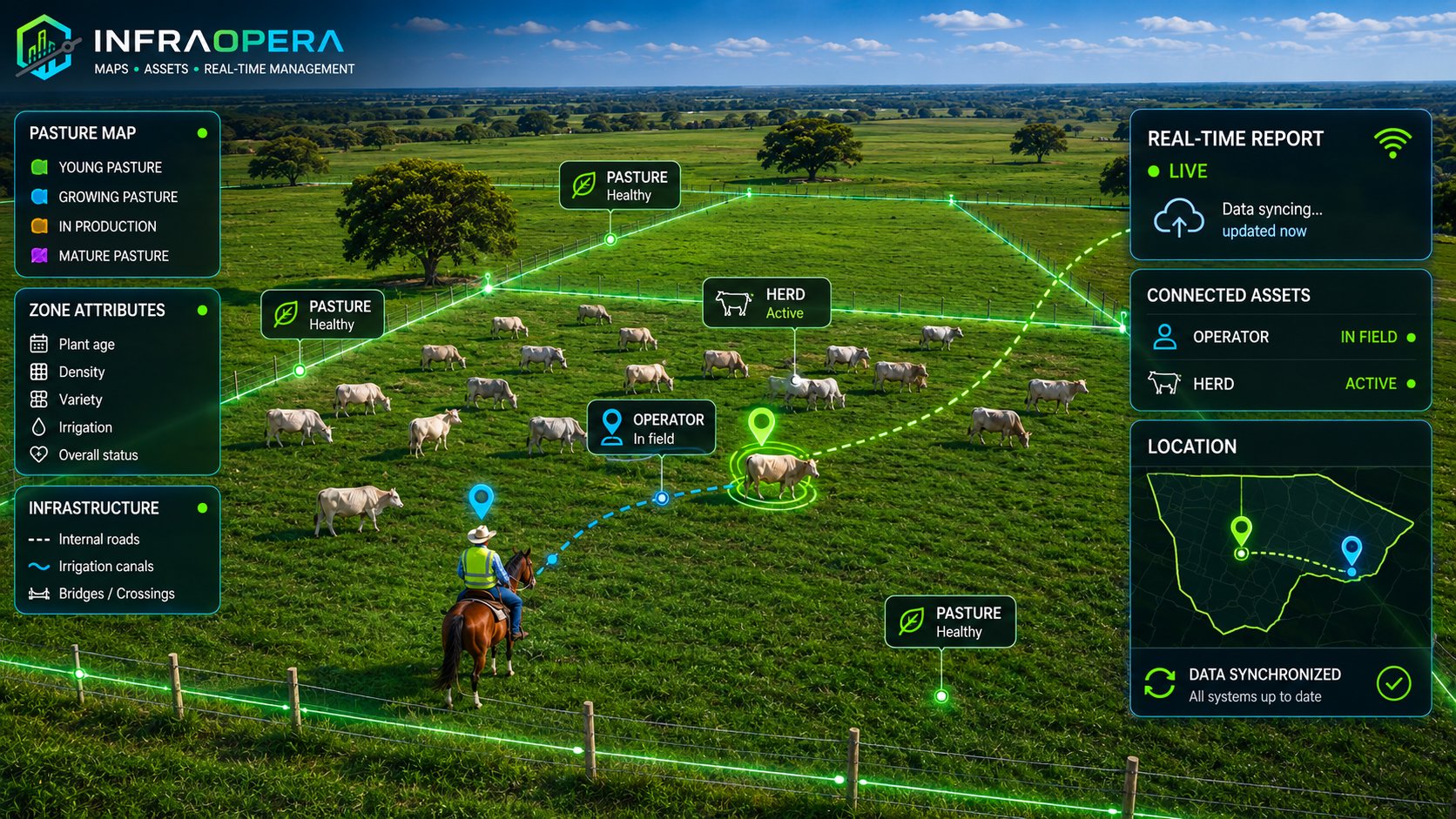
Cattle and pasture without control by geozone
Which paddock is each batch of animals in? When did it enter, how much pasture is left, when does it rotate? The weight from the last scale reading? Without geozones and dates, rotation and fattening tracking are done by eye.
InfraOpera turns the estate into an operating system
Each field and each paddock with geometry, age and status. Each task with location, evidence and date. Each production decision, backed by its own data — recorded, not estimated.
Georeferenced fields and paddocks
Each field of sugarcane, palm or citrus, and each paddock, drawn on the map with its planting date, its age or ratoon, its variety and its history. The operation's calendar stops living in memory.
Application and task geozones
You record where, when and how much of each input was applied —fertilizer, fungicide, irrigation— by geozone, with evidence. We don't prescribe the dose: we give you the geospatial traceability of what your team decided to apply.
Rotation and fattening with data
Each batch of animals located by paddock, with entry and rotation date, and the scale weight captured at each weighing. You compare the evolution across paddocks and pasture types — the rancher decides, the system records.
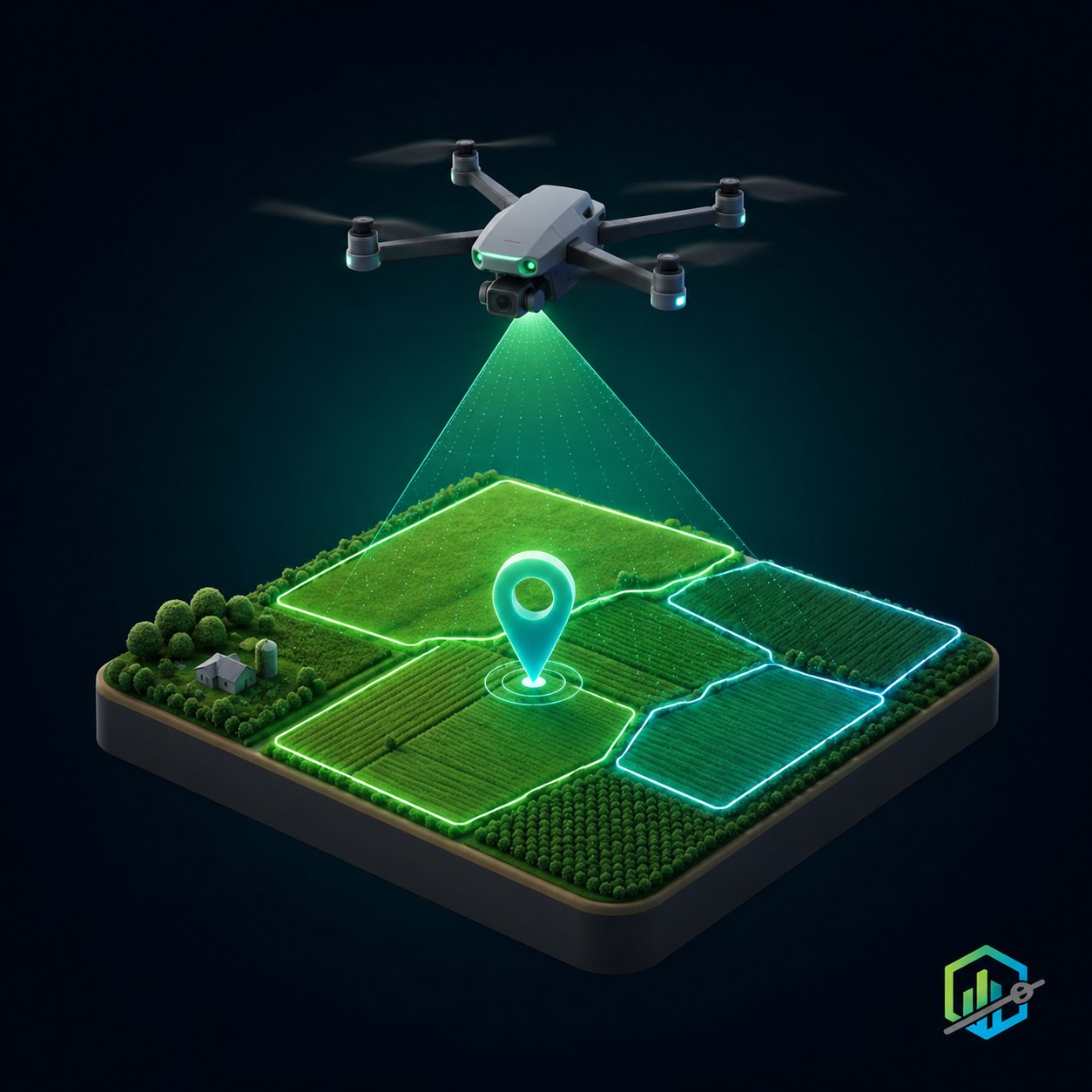
Drone capture of the estate
Engineering-grade orthomosaics and models of the estate. A baseline of fields and infrastructure, documenting status and evolution flight by flight — the basis for measuring progress and supporting claims.
The entire productive estate, on the map
From the sugarcane field to the last paddock, from the main irrigation channel to the scale. All inventoried, located, with its age and its history.
Crop fields
Sugarcane, palm, pineapple, citrus: age, variety, planting
Paddocks and cattle
Batches of animals, rotation, pasture estimate
Irrigation and hydraulics
Channels, pipes, sprinklers, pumps, wells
Internal roads
Harvest roads, bridges, access points
Warehouses and facilities
Warehouses, barns, processing plants, scales
Equipment and machinery
Tractors, harvesters, implements
From planting to closeout, with evidence
A simple, traceable operating cycle, designed for thousands of hectares and the demands of certification.
Load the estate
You upload the fields with their age and variety, the paddocks, the infrastructure and the equipment, or you capture them with a drone. The entire estate becomes live on the map.
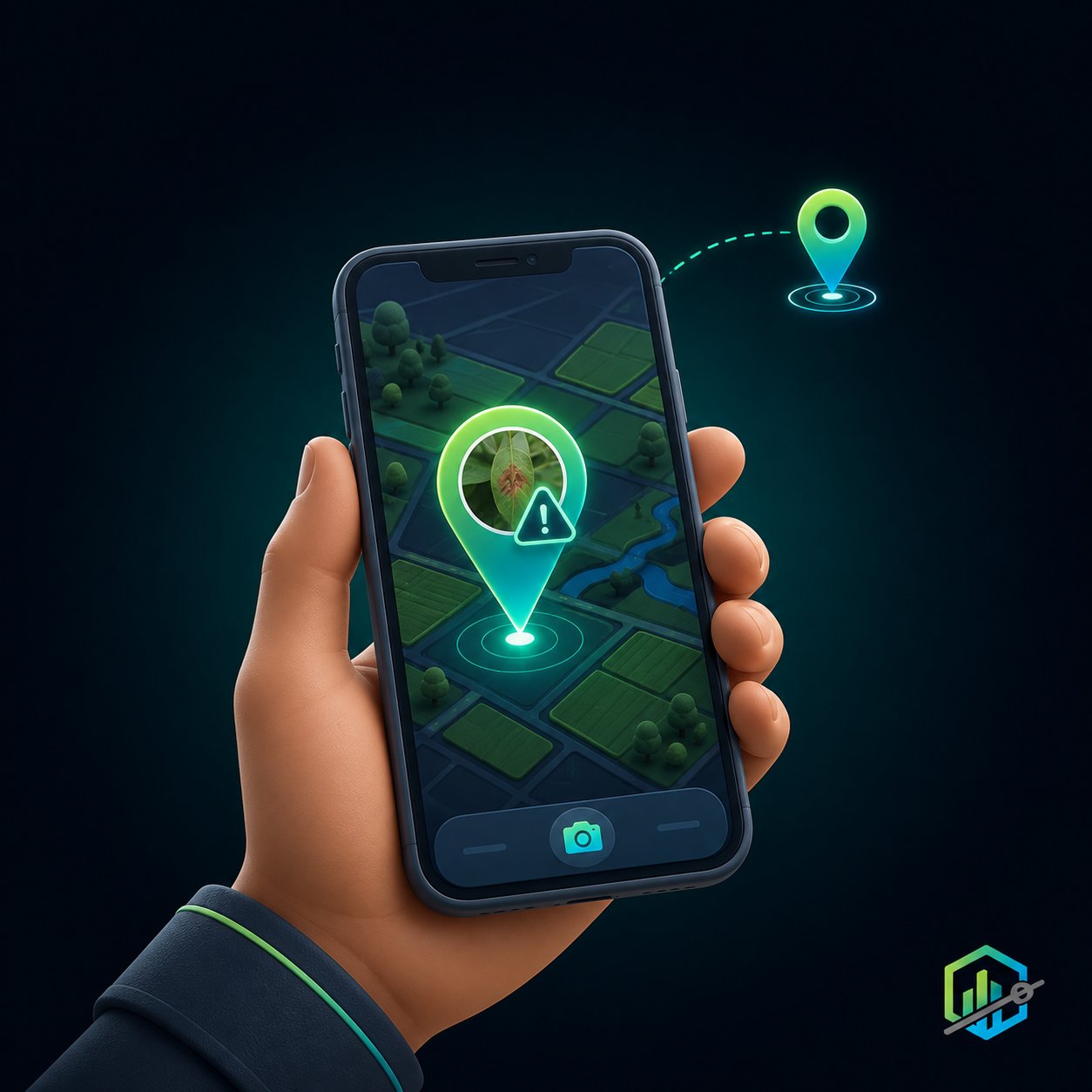
Report or detect
The worker reports a task, an irrigation failure or an event from the map, with exact location and photo, tied to the field or paddock.
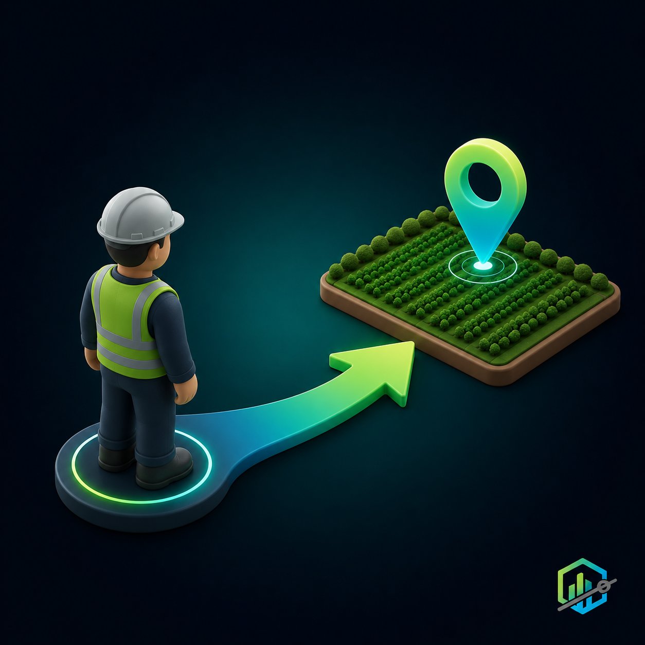
Assign and execute
The work order is assigned to staff or a contractor. On arrival at the field, the geofence registers it. They execute and upload geolocated evidence.
Validate and trace
The administrator approves with the evidence. Everything is tied to the field and its date — traceability ready for certification and the buyer.
You don't just map the estate: you trace how it evolves
Each field has a geographic history: when it was planted, how old it is, what was applied to it and how it responded compared to its neighbors. InfraOpera records that history on the map. You provide the agronomic knowledge; we give you the geospatial traceability to back it up.
Age and calendar by field
Sugarcane with staggered harvests, palm by years since planting, citrus by productive age: each field on the map with its date and status. Cutting and harvesting are planned on data, not on memory.
Comparable trials on the map
You planted a new variety in some fields and the control in others. InfraOpera records each field, its date and the tasks applied, so you can compare the geolocated evolution field by field. We measure and locate; the agronomic conclusion is yours.
Measurable fattening and rotation
The scale weight captured at each weighing, tied to the batch of animals and the paddock. Compare the evolution of a group on a cut-pasture against another — the data is recorded by geozone and date, ready for the rancher to decide.
Crops and livestock, one operation
The cut-grass that feeds the herd, the plantain leaf that goes to the cattle, the resting paddock that rotates to another field: crop-livestock integration is mapped, with its flows and dates, in the same system.
Every specimen, an asset with its own address
There's no need to tag in the field with QR codes or stakes —with their cost (hardware + supply) and wear—. The georeferenced position of each plant is its tag: it never changes. Each specimen becomes an asset in the inventory, with its task history, and you reach it by navigating to its coordinate, like an address on the map, just as you do now with Google Maps in the city.
Counting by geozone, without counting by hand
Send the drone, generate the map: the AI helps count the specimens —plants or head of cattle— and you know how many you have per geozone. No more hours walking paddocks counting cattle. The count is the aid; your team verifies it.
Count, mark and delimit on the flight. Your specialist verifies.
From the orthomosaic captured with InfraOpera Capture, the AI does the counting and detection work that takes weeks by hand, and delivers it georeferenced on the map. It's an aid for your technical team: the AI proposes, the agronomist or specialist verifies and decides. We don't diagnose the cause — we locate and quantify it.
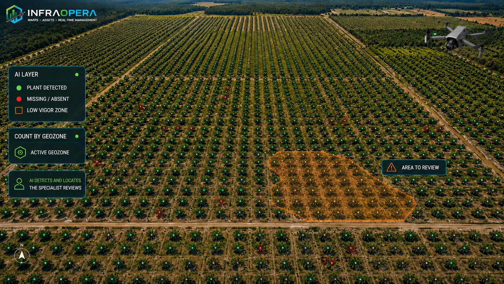
Counting individuals by geozone
The AI counts the plants detected in the field —palms, trees, shrubs— on the orthomosaic. If the geozone has the theoretical total planted loaded in its attributes, we show you the difference against the actual count; if not, we deliver the count. You define the theoretical figure; we count and compare against that data.
Gaps and deaths, one by one
The AI marks the plants that aren't responding, each with its exact coordinate — or groups them by zone when it's a cluster. Your specialist receives the points on the map and goes straight to verify, instead of walking the field blind.
Low-vigor zones delimited
Within a single field, the AI delimits as polygons the patches growing differently from the rest. You see where to investigate; the why —soil, water, pest— is determined by the agronomist. We deliver the where, measured and located.
Comparable flight by flight
Each interpretation is dated and tied to the geozone. Flight after flight, your team compares the evolution of a count, a cluster of gaps or a low-vigor zone on the same map — temporal traceability of the finding.
An estate that cares for those who work the land.
The worker in a distant field is no longer out of touch. A direct channel lets them report an irrigation failure, a broken fence, an animal in trouble or a risk. Each report reaches management with exact location, in real time, and triggers the response the operation has defined.
Each report reaches whoever must respond
Living Field is configured according to your operation's structure. You define the rule; the system routes each report to the right destination, with exact location on the estate and in real time:
- 💧 Irrigation failure A broken channel or a stopped pump in a distant field notifies the maintenance team for that sector, with exact location.
- 🐄 Animal or fence in trouble A downed fence, an open gate or an animal outside its paddock reaches the person responsible, with the affected field on the map.
- 🌿 Event in a field Staff report a visible cluster, an intrusion or a risk in a field; it's georeferenced for your team to decide and act.
The system routes and documents. Verification and the response decision remain in your operation's hands — InfraOpera executes the rule you defined.
Irrigation failure
The worker reports a leak, a stopped pump or a broken sprinkler from the site. Management dispatches the technician to the exact spot. No field left unwatered for days because no one found out.
Broken fence or loose animal
A downed fence, an open gate, an animal outside its field: anyone who sees it reports it. It's addressed before losing an animal or a crop.
From the drone's finding to the crew on the spot
The AI marked 38 gaps and a low-vigor zone in field 14. The specialist verifies them on the map and, once confirmed, dispatches the crew with the exact coordinate — without walking 200 hectares searching. The finding becomes a task with traceability.
Task executed with traceability
Each task —spraying, fertilizing, harvesting— is recorded in the field with date, person responsible and evidence. Traceability ready for certification and the buyer.
Real-time herd tracking
A GPS collar on a lead animal of the herd —InfraOpera doesn't sell it: it connects it— and you see where the group is on the map, live. You plan the sanitary application to the herd over that location and record what was applied, when and where. The vet decides the treatment; the system locates and traces it.
Every sensor, a defensible decision.
You decide what to measure and how you want to operate your estate. InfraOpera doesn't sell the hardware: it connects it. We identify in the market the open sensors your operation needs —soil moisture, weather stations, flow meters, well-level, temperature— and integrate them into the same map where your assets live, with the solution designed to fit your requirement.
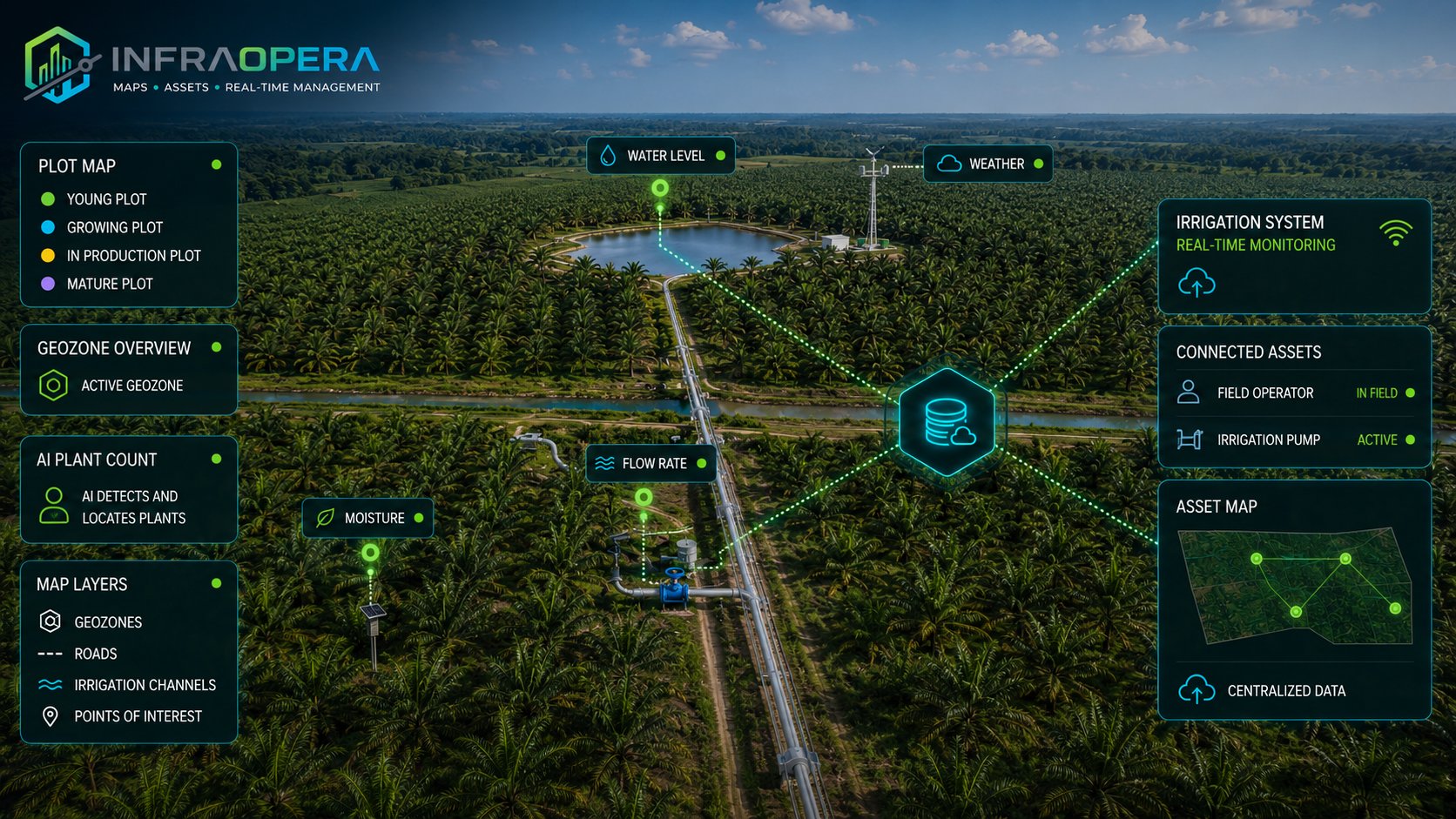
Support for traceability and certification
Water-consumption sensors and weather stations record and seal conditions and resource use, with dates. That history becomes the support to back traceability before certifications and buyers: traceable evidence, not estimates.
Prevention and protection
A level sensor in a well or a temperature sensor in a critical warehouse crosses the threshold you configured. InfraOpera generates the incident, creates an automatic geozone and triggers the response before the failure affects production.
Automatic operation
A soil-moisture sensor waters each field only when needed, saving water and energy; a weather station anticipates a frost or a storm; a flow meter detects a leak in the irrigation system. Each reading can generate a traceable work order, with the support of AI —audible or by message— that suggests action scenarios for the operator to decide.
Closeness to the operation
Telemetry doesn't just measure: it accompanies the decision. A frost alert, an irrigation leak or a critical condition can be notified to the staff who are in the geozone of the affected field, in real time, to act before losing the harvest.
What changes when you operate with InfraOpera
The backing of the estate's productive infrastructure, in one place
An agricultural estate is a high-value productive asset exposed to weather, wear and staff turnover. InfraOpera doesn't just give you operational control: it turns the infrastructure into a secure digital record, indexed and instantly searchable. It's not just production — it's verifiable backing of your traceability and your investment.
The estate's memory, not the staff on shift
Knowledge of the infrastructure stops leaving with turnover. It stays in the operation, backed up and available.
Ready for certification
Each task with its evidence, date and person responsible. What a certification or a buyer requires in traceability, you deliver documented.
Transparency for the owner
The real status of the productive infrastructure, supported and auditable. Backing that sustains investment decisions and protects the asset's value.
Your estate, field by field, under control
We set up the initial inventory of fields, paddocks and infrastructure, the operational map and a real case running. No vague promises: operational control and traceability from the first month.